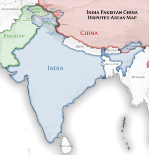
Αρχείο:India location map.svg

Το μέγεθος αυτής της PNG προεπισκόπησης αυτού του SVG το αρχείο: 557 × 600 εικονοστοιχεία. Άλλες αναλύσεις: 223 × 240 εικονοστοιχεία | 446 × 480 εικονοστοιχεία | 713 × 768 εικονοστοιχεία | 951 × 1.024 εικονοστοιχεία | 1.902 × 2.048 εικονοστοιχεία | 1.500 × 1.615 εικονοστοιχεία.
Εικόνα σε υψηλότερη ανάλυση (Αρχείο SVG, ονομαστικό μέγεθος 1.500 × 1.615 εικονοστοιχεία, μέγεθος αρχείου: 1,23 MB)
Ιστορικό αρχείου
Κλικάρετε σε μια ημερομηνία/ώρα για να δείτε το αρχείο όπως εμφανιζόταν εκείνη τη στιγμή.
| Ώρα/Ημερομ. | Μικρογραφία | Διαστάσεις | Χρήστης | Σχόλια | |
|---|---|---|---|---|---|
| τελευταία | 09:24, 4 Απριλίου 2021 |  | 1.500 × 1.615 (1,23 MB) | TKsdik8900 | Fulfilling the edit request (File talk:India location map.svg#Upload more compact version of India location map) by C1MM |
| 16:50, 14 Οκτωβρίου 2020 |  | 1.500 × 1.615 (1,64 MB) | NordNordWest | correct Telangana/Andhra Pradesh | |
| 23:10, 3 Νοεμβρίου 2019 |  | 1.500 × 1.615 (1,62 MB) | RaviC | slight colour change for consistency | |
| 23:06, 3 Νοεμβρίου 2019 |  | 1.500 × 1.615 (1,62 MB) | RaviC | == {{int:filedesc}} == {{Information |Description={{en|Location map of India. Equirectangular projection. Strechted by 106.0%. Geographic limits of the map: * N: 37.5° N * S: 5.0° N * W: 67.0° E * E: 99.0° E Made with Natural Earth. Free vector and raster map data @ naturalearthdata.com.}} |Source={{own}} |Date=2010-02-20 |Author={{user at project|Uwe Dedering|wikipedia|de}} |Permission= |other_versions={{DerivativeVersions|India location map2.svg|India location map 3.png}} {{Other versions/I... | |
| 21:42, 19 Αυγούστου 2014 |  | 1.500 × 1.615 (1,59 MB) | M0tty | Update by Sémhur : add the state of Telangana | |
| 11:51, 7 Ιουνίου 2011 |  | 1.500 × 1.615 (1,49 MB) | NordNordWest | Nagaland corrected | |
| 16:10, 18 Ιανουαρίου 2011 |  | 1.500 × 1.615 (2,36 MB) | Uwe Dedering | Reverted to version as of 15:50, 17 January 2011 and again, layer structure destroyed, and first discuss this! | |
| 19:04, 17 Ιανουαρίου 2011 |  | 1.500 × 1.615 (1,52 MB) | AshwiniKalantri | The disputed land of Kashmir are shown in a different shade. | |
| 15:50, 17 Ιανουαρίου 2011 |  | 1.500 × 1.615 (2,36 MB) | Uwe Dedering | Reverted to version as of 11:34, 22 September 2010 vandalism | |
| 23:30, 16 Ιανουαρίου 2011 |  | 1.500 × 1.615 (2,01 MB) | AshwiniKalantri | {{Information |Description=Location Map of India |Source= |Date= |Author= |Permission= |other_versions= }} |
Συνδέσεις αρχείου
Περισσότεροι από 100 σελίδες χρησιμοποιούν αυτό το αρχείο. Η ακόλουθη λίστα δείχνει τις πρώτες 100 σελίδες που συνδέονται με αυτό το αρχείο μονοσήμαντα. Η πλήρης λίστα είναι διαθέσιμη.
- Άγκρα
- Άιζολ
- Όρβιλ
- Αγκαρτάλα
- Αμριτσάρ
- Ανάνταπουρ
- Αντιλαμπάντ
- Ασανσόλ
- Ατάσου (Ουτάρ Πραντές)
- Αχμενταμπάντ
- Αχνούρ
- Βαρανάσι
- Βαρντχά
- Βαϊρένγκτε
- Βιντίσα
- Βιτζαγιαβάντα
- Βιτζαϊναγκάρ (Τσανγκλάνγκ)
- Βρινταβάν
- Γκανγκτόκ
- Γκαουχάτι
- Γκβαλιόρ
- Γκοϊντβάλ
- Δελχί
- Ερόντε
- Ιμφάλ
- Ιντόρ
- Ιταναγκάρ
- Καλκούτα
- Κανπούρ
- Καρταρπούρ (Ινδία)
- Κατάλογος των αστικών συναθροίσεων της Ινδίας με πληθυσμό άνω του 1 εκατομμυρίου κατοίκων
- Κολχαπούρ
- Κοντίνχι
- Κοτσί
- Κοχίμα
- Λάκναου
- Λουντιάνα
- Μαλκανγκίρι
- Μανγκάν (Ινδία)
- Μαντουράι
- Μαϊσόρ
- Μουμπάι
- Μπάμπα Μπακάλα
- Μπανγκαλόρ
- Μπικάνερ
- Μπιλάι
- Μποπάλ
- Μπουμπάνεσβαρ
- Μπούντι
- Νάσικ
- Νέο Δελχί
- Ναγκπούρ
- Νοαπάρα (Ινδία)
- Νταλί (Ινδία)
- Νταρ
- Νταραμσάλα
- Νταρβάντ
- Ντεραπούρ
- Ντινχάτα
- Ντιού
- Ντισπούρ
- Ντουργκαπούρ
- Οζουκαράι
- Οροπέδιο Ντέκκαν
- Ούρι
- Πάτνα
- Πίμπρι-Τσιντσβάντ
- Παταντσέρου
- Πατιάλα
- Πορτ Μπλαιρ
- Ποσίρ
- Πουντς
- Πουρούλια
- Πουσκάρ
- Πούνε
- Πραγιαγκράτζ
- Ραζκότ
- Ραμγκάρ (Τσατίσγκαρ)
- Ρασουλαμπάντ
- Σημείο Ίντιρα
- Σιάχα
- Σιλιγκούρι
- Σιλόνγκ
- Σουράτ
- Σούντορμπον
- Σριναγκάρ
- Τελούγκου
- Τζαλαντάρ
- Τζαμού
- Τζαμσεντπούρ
- Τζαϊπούρ
- Τζαϊσαλμέρ
- Τζιντζάκ
- Τζοντχπούρ
- Τινσούκια
- Τονκ (Ινδία)
- Τσαντίγκαρ
- Τσεννάι
- Τσιτόργκαρθ
- Χαλού
Δείτε περισσότερους συνδέσμους προς αυτό το αρχείο.
Καθολική χρήση αρχείου
Τα ακόλουθα άλλα wiki χρησιμοποιούν αυτό το αρχείο:
- Χρήση σε ace.wikipedia.org
- Χρήση σε af.wikipedia.org
- Leh
- Taj Mahal
- Amritsar
- Sjabloon:Liggingkaart Indië
- Indore
- Thane
- Bhopal
- Visakhapatnam
- Pimpri-Chinchwad
- Vadodara
- Ghaziabad
- Ludhiana
- Nashik
- Faridabad
- Meerut
- Rajkot
- Kalyan-Dombivali
- Vasai-Virar
- Srinagar
- Aurangabad
- Dhanbad
- Navi Mumbai
- Prayagraj
- Ranchi
- Haora
- Coimbatore
- Jabalpur
- Gwalior
- Vijayawada
- Jodhpur
- Madurai
- Raipur
- Kota
- Guwahati
- Chandigarh
- Solapur
- Hubli-Dharwad
- Indiese nasionale krieketspan
- Tiruchirappalli
- Thiruvananthapuram
- Krieketwêreldbeker 1987
- Krieketwêreldbeker 1996
- Krieketwêreldbeker 2011
- Krieketwêreldbeker 2023
- Jaynagar Majilpur
- Wes-Ghats
- Kushok Bakula Rimpochee Lughawe
Δείτε περισσότερη καθολική χρήση αυτού του αρχείου.


