Size of this preview: 800 × 577 pixels. Other resolutions: 320 × 231 pixels | 640 × 462 pixels | 994 × 717 pixels.
Original file (994 × 717 pixels, file size: 296 KB, MIME type: image/png)
File history
Click on a date/time to view the file as it appeared at that time.
| Date/Time | Thumbnail | Dimensions | User | Comment | |
|---|---|---|---|---|---|
| current | 05:47, 20 July 2012 |  | 994 × 717 (296 KB) | 117Avenue | slight fix |
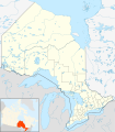
| 05:43, 20 July 2012 |  | 994 × 717 (296 KB) | 117Avenue | {{Information |Description ={{en|1=Location map of Southern Ontario, Canada. Equirectangular projection, N/S stretching 155%. Geographic limits of the map: * N: 46.4° N * S: 41.4° N * W: 84.7° W * E: 74.0°... |
File usage
More than 100 pages use this file. The following list shows the first 100 pages that use this file only. A full list is available.
- Actinolite, Ontario
- Acton, Ontario
- Actons Corners, Ontario
- Adjala-Tosorontio
- Aldershot, Burlington
- Amherstburg
- Ancaster, Ontario
- Arnprior
- Athens, Ontario
- Aurora, Ontario
- Aylmer, Ontario
- Barrie
- Bay of Quinte
- Belleville, Ontario
- Bracebridge, Ontario
- Bradford West Gwillimbury
- Brampton
- Brantford
- Brighton, Ontario
- Brock, Ontario
- Brockville
- Brussels, Ontario
- Burlington, Ontario
- Caledon, Ontario
- Cambridge, Ontario
- Carleton Place
- Clarington
- Cobourg
- Cornwall, Ontario
- East Garafraxa
- East Gwillimbury
- Erin, Ontario
- Fort Erie, Ontario
- Gananoque
- Georgetown, Ontario
- Georgina, Ontario
- Gravenhurst, Ontario
- Greater Napanee
- Greater Toronto Area
- Grimsby, Ontario
- Guelph
- Halton Hills
- Hamilton, Ontario
- Huntsville, Ontario
- Ingersoll, Ontario
- Innisfil
- Keswick, Ontario
- King, Ontario
- Kingston, Ontario
- Kitchener, Ontario
- LaSalle, Ontario
- Leamington, Ontario
- Lindsay, Ontario
- Markham, Ontario
- Midland, Ontario
- Milton, Ontario
- Mono, Ontario
- New Tecumseth
- Newmarket, Ontario
- Niagara-on-the-Lake
- Niagara Falls
- Niagara Falls, Ontario
- Oakville, Ontario
- Orillia
- Oshawa
- Ottawa
- Owen Sound
- Paris, Ontario
- Parry Sound, Ontario
- Penetanguishene
- Perth, Ontario
- Peterborough, Ontario
- Pickering, Ontario
- Point Pelee National Park
- Port Colborne
- Port Hope, Ontario
- Prescott, Ontario
- Puslinch, Ontario
- Richmond Hill, Ontario
- Sarnia
- Scugog
- Seaforth, Ontario
- Simcoe, Ontario
- Smiths Falls
- St. Catharines
- St. Thomas, Ontario
- Stratford, Ontario
- Tecumseh, Ontario
- Thorold
- Tobermory, Ontario
- Trenton, Ontario
- Uxbridge, Ontario
- Vaughan
- Walkerton, Ontario
- Walpole Island First Nation
- Waterloo, Ontario
- Welland
- West Lincoln
- Whitby, Ontario
- Whitchurch-Stouffville
View more links to this file.
Global file usage
The following other wikis use this file:
- Usage on ar.wikipedia.org
- Usage on azb.wikipedia.org
- Usage on ban.wikipedia.org
- Usage on bn.wikipedia.org
- Usage on bs.wikipedia.org
- Usage on ceb.wikipedia.org
- Usage on ckb.wikipedia.org
- Usage on cs.wikipedia.org
- Usage on eo.wikipedia.org
- Usage on fa.wikipedia.org
- پواسن
- ویتبی، انتاریو
- آرورا، انتاریو
- کالدون، انتاریو
- گریتر ناپانی
- نایاگارا-آن-د-لیک
- کبورگ
- میلتن (انتاریو)
- فورت اری (انتاریو)
- ثورولد
- بومنویل
- گویلمبری شرقی
- لینکلن، انتاریو
- گادریک، انتاریو
- پری ساوند، انتاریو
- برادفورد وست گیلیمبری
- پلیمتون وایومینگ
- سیمکو، انتاریو
- پلهم، انتاریو
- کینکاردن، انتاریو
- لیکشور، انتاریو
- پنتنگویشین
- ایلما، انتاریو
- هالتون هیلز
- گریمسبی، انتاریو
View more global usage of this file.


