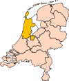
Bestaand:Limburg position.svg

Afmetingen van deze voorvertoning van het type PNG van dit SVG-bestand: 200 × 236 bealdpunten Andere resolutys: 203 × 240 bealdpunten | 407 × 480 bealdpunten | 651 × 768 bealdpunten | 868 × 1.024 bealdpunten | 1.736 × 2.048 bealdpunten.
Oorsprungelik bestand (SVG-bestand, uutgangsgroutde 200 × 236 bealdpunten, bestandsgroutde: 157 kB)
Bestandsgeskydenisse
Klik up een datum/tyd üm et bestand te seen so as et destyds was.
| Datum/tyd | Miniatuurafbealding | Groutde | Gebruker | Kommentaar | |
|---|---|---|---|---|---|
| aktueel | 18:19, 2 mrt 2019 |  | 200 × 236 (157 kB) | Thayts | update |
| 01:50, 3 okt 2006 |  | 200 × 236 (158 kB) | Mtcv | {{Information| |Description=Location of the province of Noord-Holland (North Holland) in the Netherlands. |Source=Own work, based on freely available GIS data |Date=2006-10-03 |Author=User:Mtcv |Permission=Data: attribution required; my work: PD |othe |
Bestandsgebruuk
Dit bestand wördt up de volgende syde gebruked:
Globaal bestandsgebruuk
De volgende andere wikis gebruken dit bestand:
- Gebruuk up ar.wikipedia.org
- لمبرخ (هولندا)
- ماستريخت
- فينلو
- قالب:بلديات ليمبورخ
- فالكنبورخ آن دي خول
- هيرلين
- بييك
- بيسل
- آيسدن- مارخراتن
- رورموند
- بيرخن (ليمبورخ)
- برونسوم
- إيخت- سوسترين
- خنيب
- خولبن- فيتيم
- هورست آن دي ماس
- كركرادة
- لاندخراف
- لودال
- ماسخاو
- ميرسن
- موك آن ميديلار
- نيدرفيرت
- نوت (هولندا)
- أوندربانكن
- بيل آن ماس
- روردالن
- سخينن
- سيمبلفيلد
- سيتارد- خيلين
- ستاين
- فالس (هولندا)
- فينراي
- فوريندال
- فيرت
- Gebruuk up be-tarask.wikipedia.org
- Gebruuk up cy.wikipedia.org
- Gebruuk up de.wikipedia.org
- Gebruuk up en.wikipedia.org
Globaal gebruuk van dit bestand bekyken.


