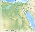
Bestand:Egypt relief location map.jpg

Grootte van deze voorvertoning: 650 × 599 pixels. Andere resoluties: 260 × 240 pixels | 520 × 480 pixels | 833 × 768 pixels | 1.055 × 973 pixels.
Oorspronkelijk bestand (1.055 × 973 pixels, bestandsgrootte: 459 kB, MIME-type: image/jpeg)
Bestandsgeschiedenis
Klik op een datum/tijd om het bestand te zien zoals het destijds was.
| Datum/tijd | Miniatuur | Afmetingen | Gebruiker | Opmerking | |
|---|---|---|---|---|---|
| huidige versie | 18 aug 2017 15:01 |  | 1.055 × 973 (459 kB) | Mélomène | According with [https://en.wikipedia.org/wiki/Hala%27ib_Triangle] |
| 13 jun 2014 20:53 |  | 1.055 × 973 (450 kB) | Sting | Color profile | |
| 13 jun 2014 20:43 |  | 1.055 × 973 (422 kB) | Sting | Updated Governorates borders shape | |
| 18 apr 2011 14:59 |  | 1.055 × 975 (415 kB) | Sting | Updated after Governorats dissolution | |
| 19 jul 2010 14:30 |  | 1.055 × 973 (451 kB) | Sting | Color profile | |
| 7 mrt 2010 20:04 |  | 1.055 × 973 (450 kB) | Sting | == {{int:filedesc}} == {{Location|26|42|00|N|30|45|00|E|scale:10000000}} <br/> {{Information |Description= {{de|Relief Positionskarte von Ägypten}} {{en|Physical location map of Egypt.}} {{fr|Carte physique vierge de l'[[:f |
Bestandsgebruik
Meer dan 100 pagina's gebruiken dit bestand. De volgende lijst geeft alleen de eerste 100 pagina's weer die dit bestand gebruiken. Er is ook een volledige lijst beschikbaar.
- Aboe Gorab
- Aboesir
- Abu Roash
- Abydos (Egypte)
- Achetaton
- Agilkia
- Aniba (Egypte)
- Antinoöpolis
- Anubieion
- Aswandam
- Athribis (Neder-Egypte)
- Avaris
- Baai van Aboukir
- Ballana
- Beni Hassan (necropolis)
- Berenike
- Bittermeren
- Boeroelloes-meer
- Boeto
- Bubastis
- Busiris (Neder-Egypte)
- Canopus (Egypte)
- Catacomben van Kom el Shoqafa
- Chenet (Egypte)
- Crocodilopolis
- Dakka (Egypte)
- Dasjoer
- Dayr al-Barsha
- Deir el-Bahri
- Deir el-Medina
- Dra' Abu el-Naga'
- Eerste Slag bij El Alamein
- El-Lahun
- El-Lisht
- Elephantine
- Gele Vloot
- Gisr el-Moedir
- Golf van Suez
- Hawara
- Heliopolis (Egypte)
- Heracleopolis Magna
- Hermopolis Magna
- Hierakonpolis
- Hoet-Nesoe
- Idkoe-meer
- Imoe
- Kalabsha
- Karanis
- Karnak (Egypte)
- Katharinaberg
- Koptos
- Leontopolis
- Letopolis
- Manzala-meer
- Mastabet el-Fara'un
- Medinet Haboe
- Meidoem
- Memphis (Egypte)
- Mendes (Egypte)
- Nabta Playa
- Naqada (stad)
- Narmoethis
- Nationaal park Ras Mohammed
- Naucratis
- Necheb
- Necropolis van Gizeh
- Oxyrhynchus
- Pelusium
- Per-Atoem
- Philae
- Pi-Ramesse
- Qarun-meer
- Qattara-depressie
- Qustul
- Sarabit al-Khadim
- Sayala
- Saïs
- Sebennytos
- Shadwan
- Sinaïberg
- Soknopaiou Nesos
- Speos Artemidos
- Tanis (Egypte)
- Taposiris Magna
- Tarchan
- Tebtynis
- Tempel van Chonsoe
- Tempel van Hibis
- Tempel van Mentoe
- Theadelphia
- Thebe (Egypte)
- Tjaroe
- Toera (Egypte)
- Umm el-Qaab
- Vallei der Koningen
- Vallei der Koninginnen
- Vallei van de Gouden Mummies
- Wadi Al-Hitan
- Wadi al-Jarf
- Xois
Meer koppelingen naar dit bestand bekijken.
Globaal bestandsgebruik
De volgende andere wiki's gebruiken dit bestand:
- Gebruikt op als.wikipedia.org
- Gebruikt op ar.wikipedia.org
- Gebruikt op arz.wikipedia.org
- Gebruikt op ast.wikipedia.org
- Canal de Suez
- Colosos de Coptos
- Muséu Exipcianu d'El Cairu
- Pirámides d'Exiptu
- Presa d'Asuán
- El Cairu
- Columna de Pompeyo
- Templu de Ramsés II (Abu Simbel)
- Módulu:Mapa de llocalización/datos/Exiptu
- Menfis
- Valle de los Reis
- Ilesia ortodoxa d'Alexandría
- Canal de los Faraones
- Biblioteca d'Alexandría
- Universidá d'al-Azhar
- Universidá d'El Cairu
- Alexandría
- Golfu d'Áqaba
- Gran Esfinxe de Guiza
- Valle de les Reines
- Gran Pirámide de Guiza
- Catacumbes de Kom el Shogafa
- Ciudadela d'El Cairu
- Península del Sinaí
- Abu Simbel
- Bibliotheca Alexandrina
- Templu d'Edfu
- Monesteriu de Santa Catalina del Monte Sinaí
- Módulu:Mapa de llocalización/datos/Exiptu/usu
- Estadiu Internacional d'El Cairu
- KV63
- Damieta
- Abu Mena
Globaal gebruik van dit bestand bekijken.


