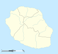
Bestand:La Réunion department relief location map.jpg

Grootte van deze voorvertoning: 645 × 600 pixels. Andere resoluties: 258 × 240 pixels | 516 × 480 pixels | 826 × 768 pixels | 1.037 × 964 pixels.
Oorspronkelijk bestand (1.037 × 964 pixels, bestandsgrootte: 244 kB, MIME-type: image/jpeg)
Bestandsgeschiedenis
Klik op een datum/tijd om het bestand te zien zoals het destijds was.
| Datum/tijd | Miniatuur | Afmetingen | Gebruiker | Opmerking | |
|---|---|---|---|---|---|
| huidige versie | 18 jul 2010 15:00 |  | 1.037 × 964 (244 kB) | Sting | Color profile |
| 23 mrt 2009 16:06 |  | 1.037 × 964 (218 kB) | Sting | == Summary == {{Location|21|07|30|S|55|31|30|E|scale:500000}} <br/> {{Information |Description={{en|Blank physical map of the department of Réunion, France, for geo-location purpose.}} {{fr|Ca |
Bestandsgebruik
Dit bestand wordt op de volgende 5 pagina's gebruikt:
Globaal bestandsgebruik
De volgende andere wiki's gebruiken dit bestand:
- Gebruikt op als.wikipedia.org
- Gebruikt op am.wikipedia.org
- Gebruikt op ar.wikipedia.org
- Gebruikt op ast.wikipedia.org
- Gebruikt op az.wikipedia.org
- Gebruikt op be.wikipedia.org
- Gebruikt op bg.wikipedia.org
- Gebruikt op bs.wikipedia.org
- Gebruikt op ceb.wikipedia.org
- Gebruikt op ce.wikipedia.org
- Gebruikt op ckb.wikipedia.org
- Gebruikt op cs.wikipedia.org
- Gebruikt op da.wikipedia.org
- Gebruikt op de.wikipedia.org
- Gebruikt op de.wikivoyage.org
- Saint-Denis (Réunion)
- Cilaos
- Saint-Pierre (Réunion)
- Saint-Leu (Réunion)
- Flughafen Réunion Roland Garros
- Le Port (Réunion)
- Le Tampon
- Saint-Paul (Réunion)
- Piton de la Fournaise
- Saint-Gilles-Les-Bains
- Diskussion:Piton de la Fournaise
- Modul:Location map data re
- Modul:Location map data re/Doku
- Saint-Philippe (Réunion)
- Gebruikt op dsb.wikipedia.org
- Gebruikt op el.wikipedia.org
Globaal gebruik van dit bestand bekijken.

