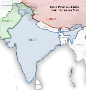
Slika:India location map.svg

Velikost tega predogleda PNG datoteke SVG: 557 × 600 točk. Druge ločljivosti: 223 × 240 točk | 446 × 480 točk | 713 × 768 točk | 951 × 1.024 točk | 1.902 × 2.048 točk | 1.500 × 1.615 točk.
Izvorna datoteka (Datoteka SVG, nominalno 1.500 × 1.615 pikslov, velikost datoteke: 1,23 MB)
Zgodovina datoteke
Kliknite datum in čas za ogled datoteke, ki je bila takrat naložena.
| Datum in čas | Sličica | Velikost | Uporabnik | Komentar | |
|---|---|---|---|---|---|
| trenutno | 10:24, 4. april 2021 |  | 1.500 × 1.615 (1,23 MB) | TKsdik8900 | Fulfilling the edit request (File talk:India location map.svg#Upload more compact version of India location map) by C1MM |
| 17:50, 14. oktober 2020 |  | 1.500 × 1.615 (1,64 MB) | NordNordWest | correct Telangana/Andhra Pradesh | |
| 00:10, 4. november 2019 |  | 1.500 × 1.615 (1,62 MB) | RaviC | slight colour change for consistency | |
| 00:06, 4. november 2019 |  | 1.500 × 1.615 (1,62 MB) | RaviC | == {{int:filedesc}} == {{Information |Description={{en|Location map of India. Equirectangular projection. Strechted by 106.0%. Geographic limits of the map: * N: 37.5° N * S: 5.0° N * W: 67.0° E * E: 99.0° E Made with Natural Earth. Free vector and raster map data @ naturalearthdata.com.}} |Source={{own}} |Date=2010-02-20 |Author={{user at project|Uwe Dedering|wikipedia|de}} |Permission= |other_versions={{DerivativeVersions|India location map2.svg|India location map 3.png}} {{Other versions/I... | |
| 22:42, 19. avgust 2014 |  | 1.500 × 1.615 (1,59 MB) | M0tty | Update by Sémhur : add the state of Telangana | |
| 12:51, 7. junij 2011 |  | 1.500 × 1.615 (1,49 MB) | NordNordWest | Nagaland corrected | |
| 17:10, 18. januar 2011 |  | 1.500 × 1.615 (2,36 MB) | Uwe Dedering | Reverted to version as of 15:50, 17 January 2011 and again, layer structure destroyed, and first discuss this! | |
| 20:04, 17. januar 2011 |  | 1.500 × 1.615 (1,52 MB) | AshwiniKalantri | The disputed land of Kashmir are shown in a different shade. | |
| 16:50, 17. januar 2011 |  | 1.500 × 1.615 (2,36 MB) | Uwe Dedering | Reverted to version as of 11:34, 22 September 2010 vandalism | |
| 00:30, 17. januar 2011 |  | 1.500 × 1.615 (2,01 MB) | AshwiniKalantri | {{Information |Description=Location Map of India |Source= |Date= |Author= |Permission= |other_versions= }} |
Uporaba datoteke
Datoteka je del naslednjih 92 strani slovenske Wikipedije (strani drugih projektov niso navedene):
- Agra, Indija
- Ahmedabad
- Alai Darwaza
- Alappuzha
- Bazilika Santa Cruz v Fort Koči
- Belur, Karnataka
- Botanični vrt Lal Bagh
- Dardžiling
- Delhi
- Durgiana tempelj
- Džagdiš (tempelj)
- Džantar Mantar, Džaipur
- Džodhpur
- Emanuel (utrdba)
- Fatehpur Sikri
- Gangtok
- Gorska železnica Nilgiri
- Gorske železnice Indije
- Halebidu
- Hampi
- Hansi
- Hava Mahal
- Hiderabad
- Himalajska železnica Darjeeling
- Humajunova grobnica
- Jaynagar Majilpur
- Kalkuta
- Kesarijadži
- Koči, Indija
- Lalitha Mahal
- Leh
- Madurai
- Mestna palača, Džaipur
- Mestna palača, Udaipur
- Monsunska palača
- Mumbaj
- New Delhi
- Nizozemska Indija
- Ooty
- Palača Matančeri
- Palača Padmanabhapuram
- Palača Thandžavur Marata
- Patadakal
- Petkova mošeja, Delhi
- Petkova mošeja, Fatehpur Sikri
- Pulikat
- Qutub Minar
- Rdeča trdnjava
- Samostan Alči
- Samostan Karša
- Samostan Likir
- Seznam krajev Unescove svetovne dediščine v Indiji
- Slapovi Šivanasamudra
- Stari Delhi
- Tempelj Airavatesvara
- Tempelj Brihadisvara v Gangaikonda Čolapuram
- Tempelj Brihadisvara v Thandžavurju
- Tempelj Džambukešvarar, Thiruvanaikaval
- Tempelj Halasuru Somešvara, Bangalore
- Tempelj Hojsalešvara
- Tempelj Jaganath, Puri
- Tempelj Kaši Višvanath
- Tempelj Kedarešvara, Halebidu
- Tempelj Kodal Azhagar
- Tempelj Menakši, Madurai
- Tempelj Nagešvara, Begur
- Tempelj Padmanabhasvami
- Tempelj Ranganathašvami, Srirangam
- Tempelj Čamundešvari
- Tempelj Čenakešava, Belur
- Thandžavur
- Thirumalai Najakar Mahal
- Tiručirapali
- Trdnjava Amber
- Trdnjava Gagron
- Trdnjava Gobindgarh
- Trdnjava Golkonda
- Trdnjava Kumbhalgarh
- Trdnjava Mehrangarh
- Trdnjava Ranthambore
- Trdnjava sv. Jurija, Čenaj
- Varanasi
- Vidhana Soudha
- Zlati tempelj
- Čenaj
- Čeruvali
- Železni steber, Delhi
- Železnica Kalka-Šimla
- Uporabnik:Stebunik/peskovnik15 - MasonRamsey
- Modul:Location map/data/India
- Modul:Location map/data/Indija
- Modul:Location map/data/Indija/dok
Globalna uporaba datoteke
To datoteko uporabljajo tudi naslednji vikiji:
- Uporaba na ace.wikipedia.org
- Uporaba na af.wikipedia.org
- Leh
- Taj Mahal
- Amritsar
- Sjabloon:Liggingkaart Indië
- Indore
- Thane
- Bhopal
- Visakhapatnam
- Pimpri-Chinchwad
- Vadodara
- Ghaziabad
- Ludhiana
- Nashik
- Faridabad
- Meerut
- Rajkot
- Kalyan-Dombivali
- Vasai-Virar
- Srinagar
- Aurangabad
- Dhanbad
- Navi Mumbai
- Prayagraj
- Ranchi
- Haora
- Coimbatore
- Jabalpur
- Gwalior
- Vijayawada
- Jodhpur
- Madurai
- Raipur
- Kota
- Guwahati
- Chandigarh
- Solapur
- Hubli-Dharwad
- Indiese nasionale krieketspan
- Tiruchirappalli
- Thiruvananthapuram
- Krieketwêreldbeker 1987
- Krieketwêreldbeker 1996
- Krieketwêreldbeker 2011
- Krieketwêreldbeker 2023
- Jaynagar Majilpur
- Wes-Ghats
- Kushok Bakula Rimpochee Lughawe
Oglejte si globalno uporabo te datoteke.


